Clouds and Predicting Garden Weather
Clouds often indicate weather changes.
The source of clouds is water that evaporates into the air. The water can come from oceans, lakes, and rivers. Plants also give off water vapor.
Clouds form when water vapor cools and condenses. Condensed water droplets ride air currents as clouds.
Water droplets riding air currents may (1) ride along; (2) rise and freeze turning into ice crystals; (3) collide with other droplets to form larger drops that become heavy enough to fall to the ground as rain or sleet.
Clouds are constantly moving and constantly forming new combinations. The clouds you see in the sky at this moment may change into different clouds in a few minutes or a few hours.
To describe and name clouds, we look at their shape and altitude or their altitude and shape.
Three types of clouds
There are three key types of clouds:
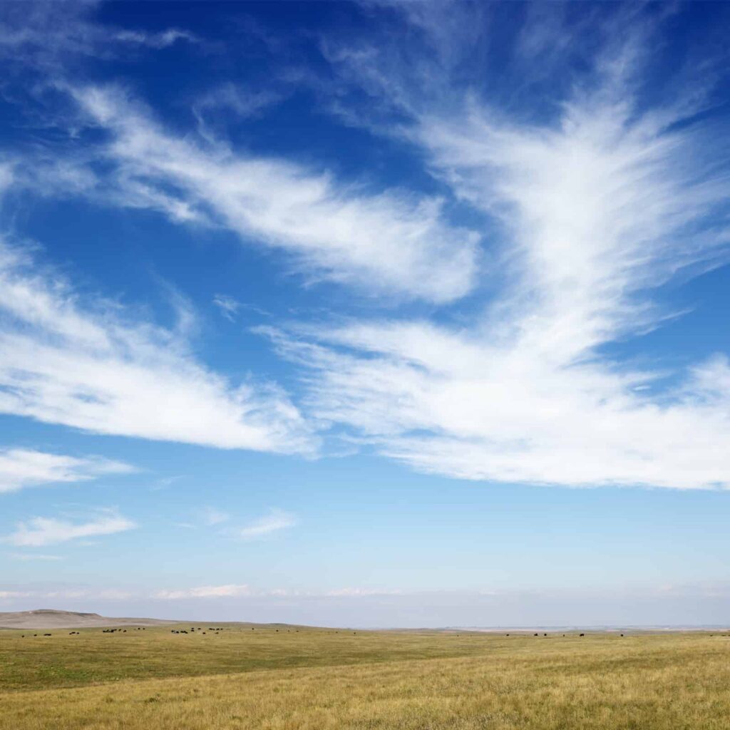
Cirrus clouds
Cirrus clouds which are wispy and curl-like and are high in the sky.
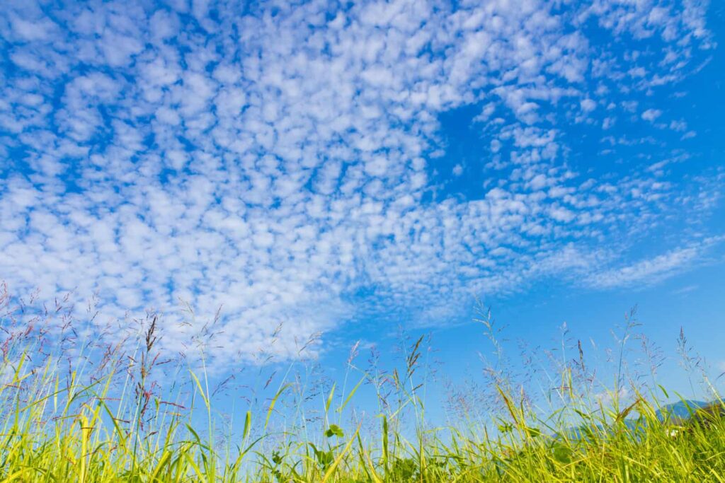
Cumulus clouds
Cumulus clouds which appear puffy and heaped-up—these clouds can be white or they can have yellowish tops and black undersides; these clouds are slightly lower than mid-level in the sky.
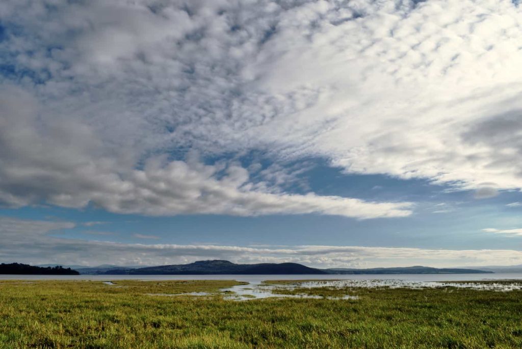
Stratus clouds
Stratus clouds appear as a dull, flat horizontal layer–like a veil; these clouds are low in the sky but do not touch the ground.
Nimbus and Alto clouds
When talking about clouds, there are two other common references:
- Nimbus which means rain cloud; a nimbus cloud has rain falling from it.
- Alto refers to the middle regions of the sky; alto clouds appear in the mid-sky.
Clouds and altitude
Additionally, clouds are classed by altitude:
High clouds
High clouds form at 20,000 to 50,000 feet. High clouds are thin because there is little moisture in the air at high altitudes. High clouds are Cirrus clouds—which are wispy and Cirrocumulus clouds—which are wispy and a bit heaped up.
Middle clouds
Middle or medium clouds form at 7,000 to 20,000 feet. Medium clouds are ever-moving, they change in shape and color as they move from one level to another. Altostratus clouds are middle, layered clouds. Altocumulus clouds are middle, heaped-up clouds. Altostratus clouds often turn into Nimbostratus clouds—layered rain clouds. Middle clouds often have pale gray undersides. The sun and moon are always visible through middle clouds—but their outlines may be dim or indistinct.
Low clouds
Low clouds form from the ground to 7,000 feet. Low clouds include Cumulus clouds which appear heaped up, Stratus clouds which are layered, Cumulonimbus clouds which are heaped-up dark rain clouds, and Nimbostratus clouds which are dark rain clouds that are layered. Low clouds can have dark undersides and usually obscure the sun or moon.
Clouds do not form above a height of about 50,000 feet, where the stratosphere begins and all moisture has already been exhausted at lower altitudes.
Clouds to know from high to low
- Cirrus clouds are high in the sky, delicate and wispy usually consisting of minute swashes of ice crystals (the temperature at 30,000 feet is -48°F /-44°C if the temperature at ground level is 59°F/15°C). Very high clouds are always cirrus clouds.
- Cirrocumulus clouds are high in the sky, curl-like or heaped up; these clouds usually mean fair weather.
- Altostratus clouds are mid-level in the sky, layered or striped clouds looking like frosted glass; these clouds usually mean light rain.
- Altocumulus clouds are mid-level in the sky, heaped up to form puffy patches or parallel bands; these clouds often mean rain.
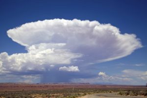
- Cumulonimbus clouds are low-in-the-sky thunderheads with anvil-like tops and ragged edges; these clouds mean a storm is near; thunder and lightning commonly accompany cumulonimbus clouds.
- Cumulus clouds are low in the sky puffy, heaped-up; these clouds mean fair weather.
- Nimbostratus clouds are low in the sky, rumpled, dark sheets of cloud; these clouds produce rain or snow.
- Stratus clouds are low in the sky but do not touch the ground; these clouds are like a fog overhead and they may produce a drizzle.
Using clouds to predict the weather
Looking at clouds is one way to predict the weather. Clouds are ever changing so you may need to look at the sky more than once to know what weather is coming.
To predict the weather look at (1) the altitude clouds are forming, and (2) the color of the clouds—as more significant amounts of water accumulate in a cloud, the cloud becomes denser and darker; as water droplets aggregate they will likely fall to the ground as rain, sleet, or snow.
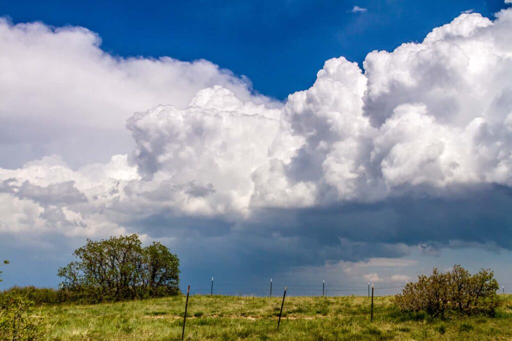
Cumulus clouds — fair weather to rain
Cumulus clouds commonly indicate fair weather. Cumulus clouds are often seen on bright summer days.
Cumulus clouds are flat at the bottom and billowy above.
They are formed by a mass of unstable air, usually, air warmed at the ground that is rising. As the warm air rises from the earth—often the air is rising from a patch of bare ground heated by the sun–it cools and the vapor in the rising air condenses into the visible cumulus cloud.
Think of each cumulus cloud as the top of a column of rising air.
The flat bottom of the cumulus cloud indicates the altitude at which the rising vapor has cooled to the point of condensation. Cumulus clouds commonly appear at 3,000 to 6,000 feet (914-1,828 m) but can form and rise higher.
Low cumulus clouds drift across the sky on the breeze and are often mistaken for sheep or wispy sailing ships by children. These billowy white cumulus clouds are more specifically called cumulus humilis.
Not all cumulus clouds are white and billowy. On hot, muggy summer days, cumulus clouds can become more menacing with yellowish tops and black undersides.
When cumulus clouds are forced high into the sky by very unstable air, they are called cumulus congestus or towering cumulus clouds. These clouds resemble the head of a cauliflower.
Cumulus congestus clouds can extend upward to as high as 39,000 feet (12,000 m).
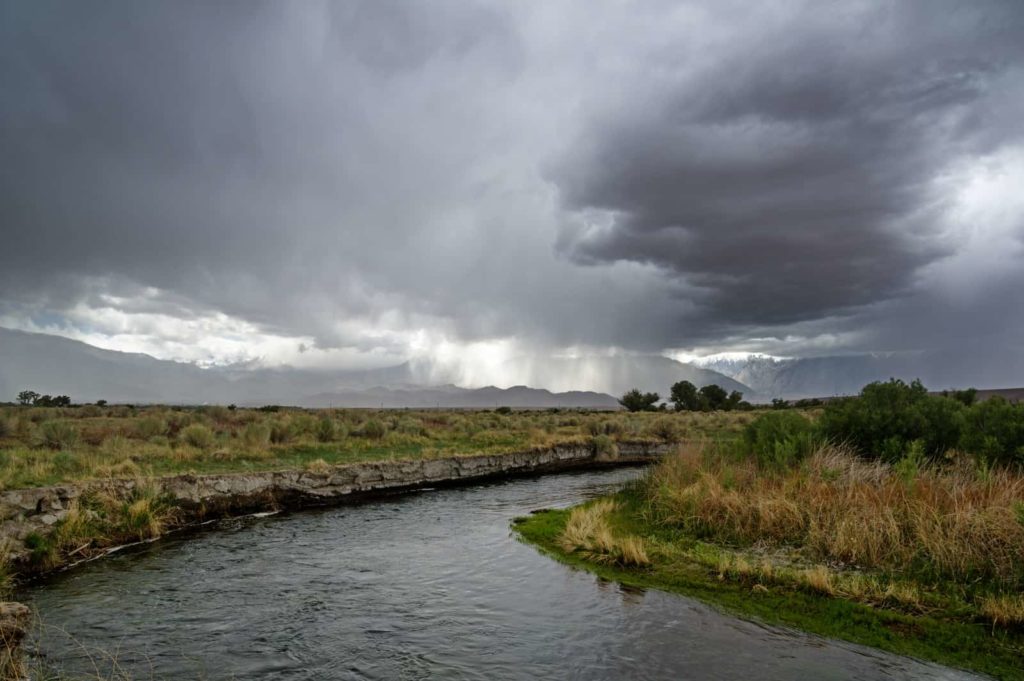
When cumulus congestus clouds produce rain they are called cumulonimbus clouds. Cumulonimbus clouds often form flat, anvil-like tops. These are known as thunderheads and usually bring rain, thunder, and lightning.
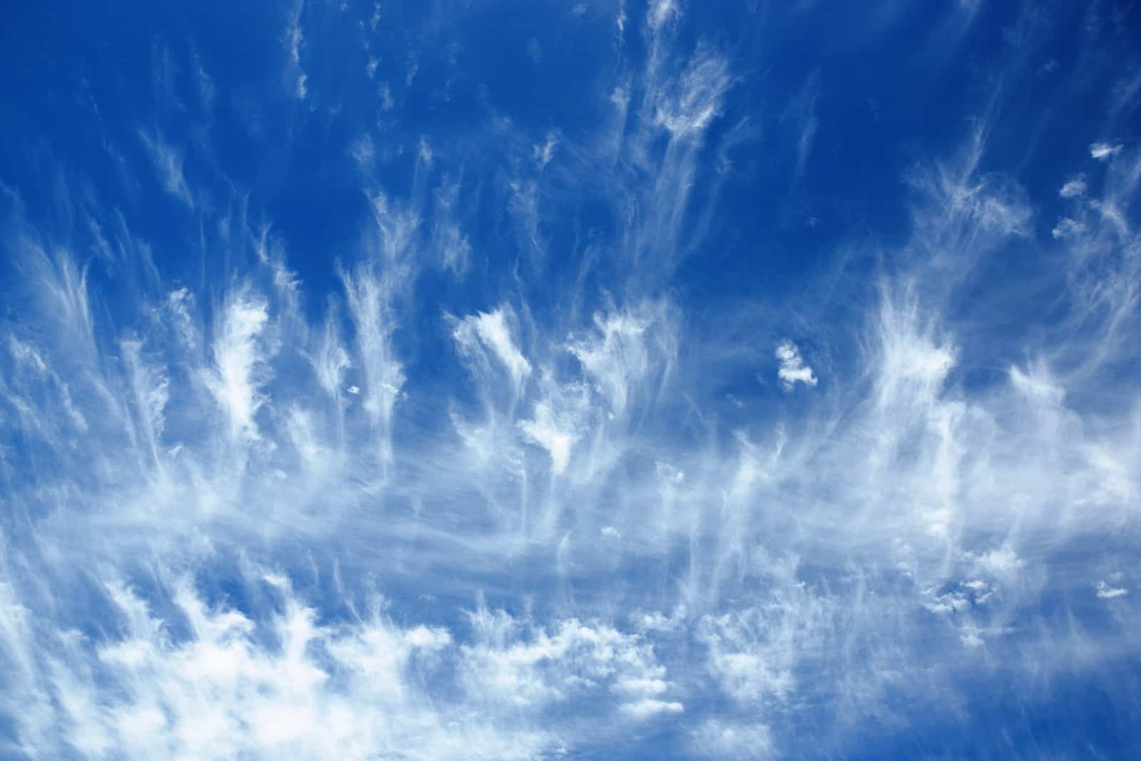
Cirrus clouds — perhaps a storm approaching

Cirrus clouds generally occur in fair weather, but they can also hearld the leading edge of a far-away storm or may mark the edge of a storm passing to the north.
Cirrus clouds are transparent wispy curls or filaments of cloud floating high in the sky. They commonly point in the direction of the air movement at their elevation.
Cirrus clouds are formed by the freezing of rising water vapor into tiny ice crystals. Cirrus clouds are so high in the upper regions of the sky that the temperature there is always below freezing and water vapors that rise that high will freeze and remain frozen.
Anytime you see a cirrus cloud, you know that it is 20,000 feet (6,000 m) in the sky or higher. That is the altitude at which water vapor turns into a solid.
All clouds between 20,000 and 50,000 feet high bear the prefix “cirro”–cirro in Latin means curl—as in curly lock of hair or ringlet.
Cirrus clouds are so curly, wispy, and feathery that they are often called “mares’ tails.” Children sometimes mistake cirrus clouds for the goose down from a broken pillow.
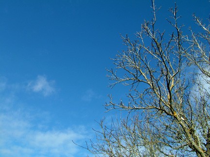
Cirrus clouds are so insubstantial that they do not dim the brightness of the sun or moon-like other clouds. As well, they cast no shadows. From Earth cirrus clouds appear transparent white or light gray.
Cirrus clouds sometimes appear straight, other times they look like floating commas, and other times they may become tangled. A cirrus cloud that is drawn out in a flat, featureless weave of filaments is called a cirrostratus cloud.

When cirrus clouds appear in clusters of tiny balls or tufts they are called cirrocumulus clouds. A collection of cirrocumulus clouds is sometimes referred to as a “mackerel sky” or “buttermilk sky.”
The ice crystals in cirrus clouds do not fall to the ground like rain. When they fall, they are carried by the wind and fall much more slowly. Their fall is often seen as streaks in the sky—called fall streaks. These falling ice crystals evaporate long before reaching the ground. The change in wind with height determines how quickly ice crystals fall and, in turn, determines the shapes and sizes of fall streaks.
Contrails that appear behind high-flying jets are manmade cirrus clouds. They are formed when water vapor from engine exhaust condenses into ice crystals.
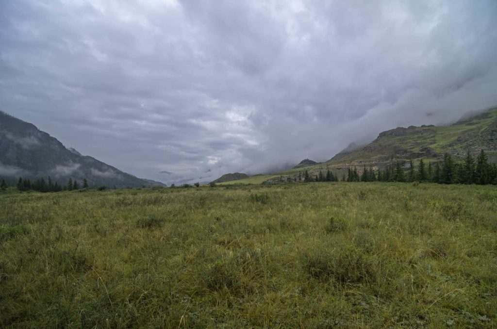
Stratus clouds — stormy weather ahead
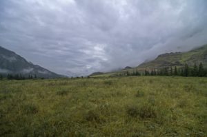
Stratus clouds are dull, flat, heavy horizontal clouds that lay low in the sky. They are commonly gray but can be white.
Stratus clouds often bring a drizzle or they can bring snow.
The altitude of stratus clouds indicates how fast a storm is approaching. Low stratus clouds usually mean rain will begin soon.
Stratus clouds appear as a hazy veil. They are featureless and depressing. Sometimes they are called “high fog.” They always obscure the sun.
The word “stratus” comes from the Latin prefix “strato-“, meaning “layer”.
Stratus clouds form when a uniform sheet of relatively warm, moist air rises up and comes to rest against a higher, uniform sheet of heavier cool air. Stratus clouds indicate that the atmosphere is organized into stable horizontal layers. This commonly happens when a front of warm air is advancing against a mass of cold air.

Stratus clouds often linger for days as prolonged cloudy weather.
When a stratus cloud produces precipitation it is called a nimbostratus cloud. Dark, heavy nimbostratus clouds can drop steady rain for hours.
Heavy, horizontal stratus clouds can be contrasted to cumulus clouds which are formed by accumulations of warm air rising in columns.
When an accumulation of warm air breaks through a higher mass of cool air it can billow up to form a stratocumulus cloud. When stratus clouds form higher than 7,000 feet, they are called altostratus clouds.
Photos of clouds